Results for "Discovered"
Pavlopetri, Greece’s Ancient Underwater City


Pavlopetri (or “Paulopetri”) is a small islet off the coast of Laconia in the southern Peloponnese, where ancient history meets the endless blue of the Mediterranean Sea.

This lovely place, which remains almost completely unknown to the majority of people, hides one of the most amazing stories in Greek history, since it is the oldest ancient Greek city that has ever been discovered underwater.

Its name, which literally translates to ”Paul’s Stone,” is directly related to St. Peter and St. Paul, the two greatest Christian apostles and martyrs, who traveled far and wide spreading Christianity during the first century AD.

The city’s long history, however, stretches nearly 5,000 years back into antiquity, since the broader region was known to have been inhabited during the earliest years of Greek history.

Discovered in 1967 by Nicholas Flemming, this ancient Greek town is now the oldest underwater “lost city” in the Mediterranean Sea — and one of the oldest such cities anywhere on the globe.

The year after Pavlopetri’s discovery, in 1968, archaeologists from the University of Cambridge in the UK visited this extraordinary place to map the entire location and to determine the extent of the ancient lost city.

At first, the scientists believed that their discovery was originally of a Mycenaean-era city, but later research revealed that it was actually much older.

More specifically, scientists were able to determine that Pavlopetri was first inhabited in 2800 BC, after elements dating back to the Bronze age were found and identified.

Perhaps the most unique feature of this area is that up until now, its overall layout has remained intact, making it a location of extraordinary importance to archaeologists.

Researchers believe that the city was submerged after a series of three cataclysmic earthquakes occurred in the area around 1000 BC.

These violent seismic events, which led to the city never being able to re-emerge from the bottom of the sea, played a crucial role in maintaining its original characteristics.

Untouched by human intervention, its secrets have remained unknown for thousands of years.

Just over the last decade, new state-of-the-art technology has enabled scientists to discover that the underwater city is comprised of at least fifteen large buildings, lying approximately four meters (13 feet) under the surface of the sea.

Now there are hopes that modern technology will further assist scientists to uncover even more hidden mysteries of this ancient world, making it more widely known and possibly even accessible to visitors via organized tours.

Mehdi Qazi Thursday, April 15, 2021
The Ruins of a Massive Ancient City Have Been Discovered in Guatemala

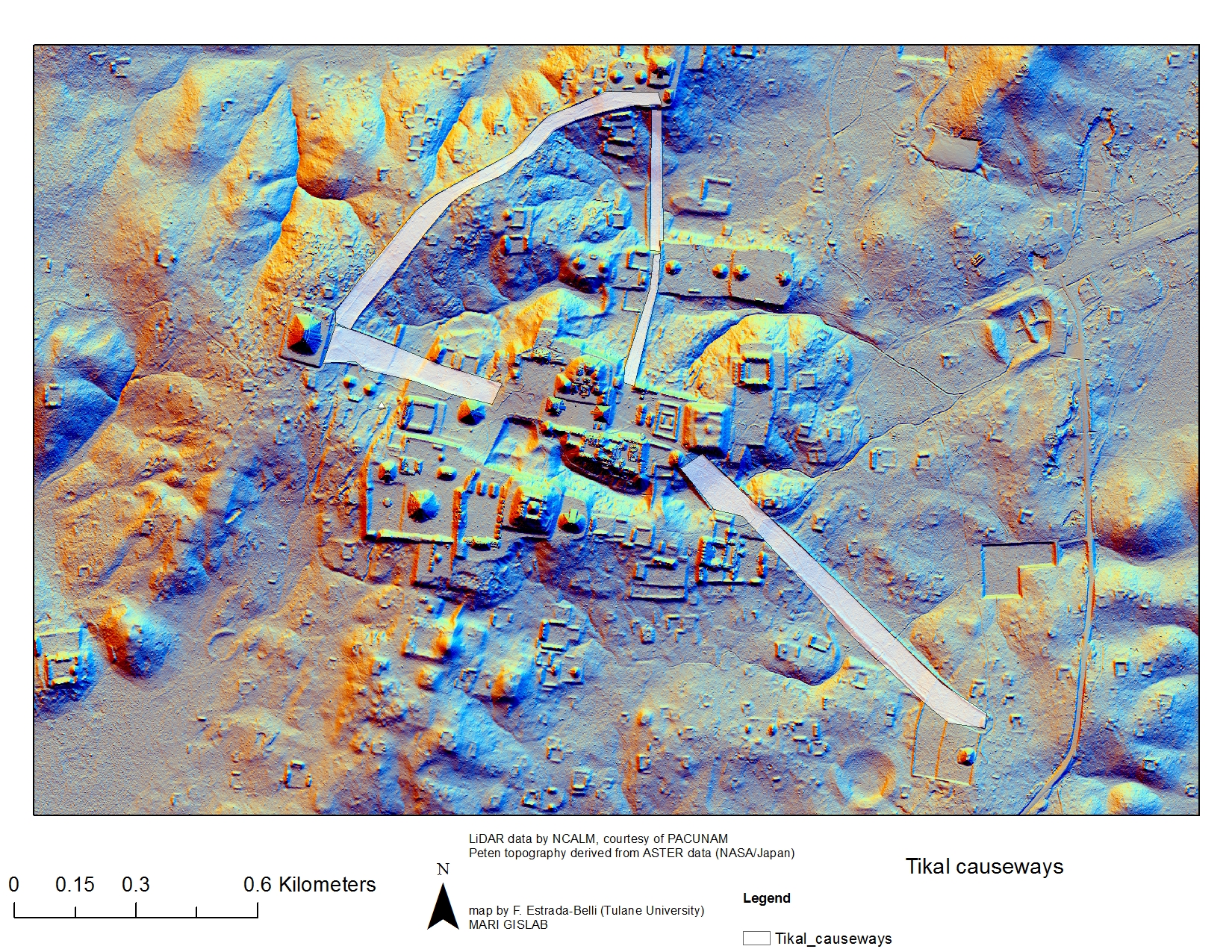
The ruins of an enormous Maya ‘megalopolis’ have been discovered in Guatemala with the help of the remote sensing technique LiDAR, according to a bombshell exclusivefrom National Geographic on Thursday. This vast lost city envelops sites like Tikal, Holmul, and Witzna—known for their temples and pyramids—but shows that these famous heritage areas are the tip of the iceberg of this lost urban network.
Hidden under the dense jungle canopies of the Maya Biosphere Reserve, more than 60,000 human-made features—homes, canals, quarries, highways, and more—have been identified in aerial imagery collected by an international collaboration of researchers headed by the PACUNAM Foundation, a Maya cultural and natural heritage organization.
This pre-Columbian civilization is estimated to have peaked some 1,200 years ago. The data suggests it may have supported a population of 10-15 million over the newly surveilled area of 800 square miles (2,100 square kilometers).
The advanced infrastructure, which includes agricultural terracing and elevated trade routes to prevent flooding in rainy seasons, has experts rethinking the dimensions and complexity of the Maya empire.
These ancient peoples obviously established a robust and imaginative culture based on their known relics, but the new research has revealed that the scale of this lost society is far beyond what experts had imagined. The findings will be explored in an hour-long documentary called "Lost Treasures of the Maya Snake Kings," premiering Tuesday, February 6 on the National Geographic Channel.

A new pyramid found south of Tikal’s Mundo Perdido. Image: PACUNAM/Canuto & Auld-Thomas
This breakthrough was possible thanks to LiDAR (Light Imaging, Detection, And Ranging) sensors, which can survey landscapes in 3D by bouncing laser pulses off the ground from drones and other aerial vehicles. LiDAR is exceptionally useful for detecting archeological sites, as it penetrates through jungle cover and other features that hinder exploration on the ground.
The technique has been the catalyst of many discoveries in recent years, including major finds at Angkor, Cambodia and Caracol, Belize. Given that the newly announced Maya “megalopolis” is the result of the first phase of PACUNAM’s LiDAR Initiative, which began in 2014, there are likely to be many more revelations about the mysterious people who built this massive urban network. The ultimate goal is to survey 5,000 square miles (14,000 square kilometers) of Guatemala’s lowlands with LiDAR sensors.
“There are entire cities we didn’t know about now showing up in the survey data,” Francisco Estrada-Belli, a National Geographic Explorer and one of the lead archeologists on the project, says in NatGeo’s forthcoming documentary.

“There are 20,000 square kilometres more to be explored and there are going to be hundreds of cities in there that we don’t know about,” he added. “I guarantee you.”

Mehdi Qazi Saturday, April 13, 2019

Facebook